docomap
GPS
GPS terminal dedicated to DoCoMAP
Easy Positional Information Device

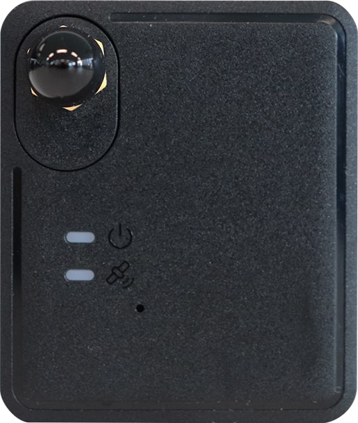
GPS terminal for acquiring location information with DoCoMAP. The terminal itself is one of the smallest in the industry, making it easy to install, and the GPS receives from five different satellites, including the quasi-zenith satellite MICHIBIKI, so the accuracy of the location information is high.The GPS location information transmission interval is once every 20 seconds, and the accuracy of the driving tracks displayed on DoCoMAP is also high. The device is also highly suitable for DX data acquisition.
*Due to low inventory, we are currently not accepting new orders.
Base Price:
Rent
Monthly rental:
1,780
円/台(税込1,958円)
* The main unit is rented and must be returned at the time of cancellation.
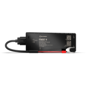
バッテリー直結型GPS端末

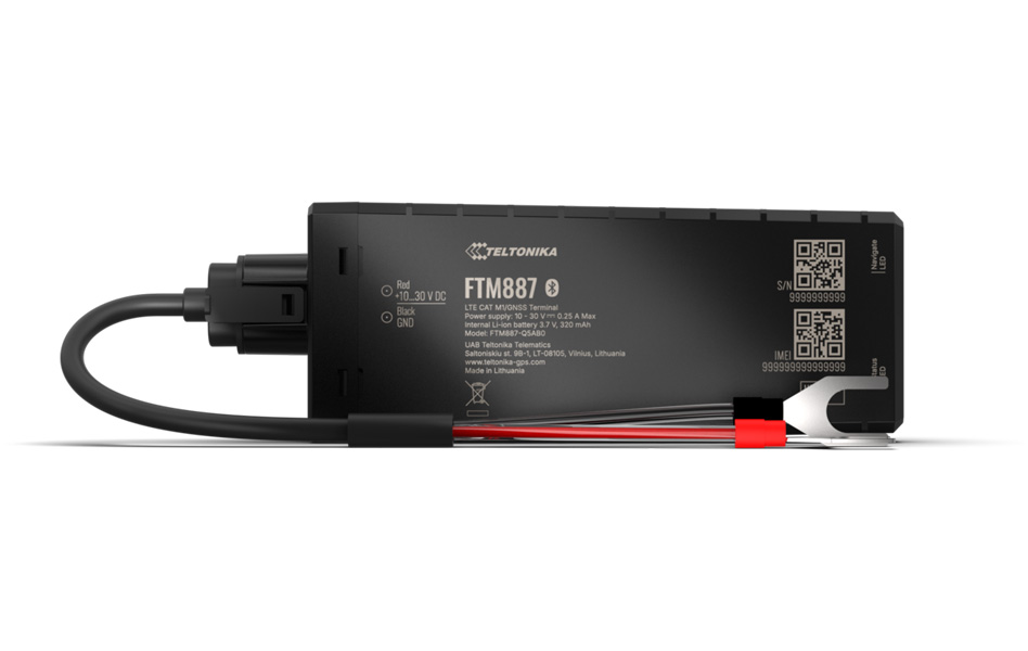
The Teltonika FTM887 GPS tracker is now compatible with DoCoMAP. This GPS tracker can be installed by connecting it directly to the vehicle’s battery. It features IP69K-rated dust and water resistance, making it suitable for use in rainy conditions or when subjected to high-pressure washing. The GPS acquires location data at 10-second intervals, enabling high-frequency monitoring of the vehicle's movement; this makes it the ideal product for sites requiring detailed management of vehicle movements.
Base Price:
Open
Monthly fee:
1,280
円/台(税込1,408円)
Basic Information
Specifications
Features


Easy Positional Information Device
GPS terminal for acquiring location information with DoCoMAP. The terminal itself is one of the smallest in the industry, making it easy to install, and the GPS receives from five different satellites, including the quasi-zenith satellite MICHIBIKI, so the accuracy of the location information is high.The GPS location information transmission interval is once every 20 seconds, and the accuracy of the driving tracks displayed on DoCoMAP is also high. The device is also highly suitable for DX data acquisition.
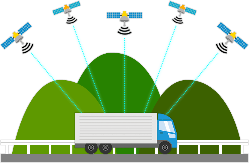
GNSS Positioning Satellite System
The Easy Location Terminal uses five satellite positioning systems: US GPS, Japan's MICHIBIKI (QZSS], Russia's GLONASS, Europe's Galileo, and China's BeiDou, allowing it to obtain more accurate location information.
Transmission Interval
Receiving position data once every 20 seconds, the device is also highly accurate in terms of the driving trajectory displayed on DoCoMAP, making it ideal for DX data acquisition.
docomapPLUS Support
Supports the docomapPLUS application for DoCoMAP, which records operation status using a smartphone, enabling real-time recording and management of operation status linked to vehicle location information in the cloud, as well as daily operation reports and labor management.
DoCoMAP Support
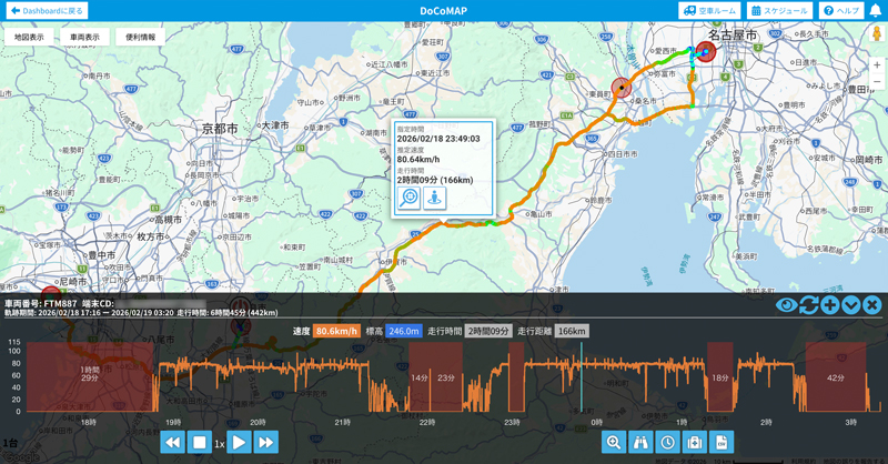
In addition to real-time location information, vehicle travel tracing, operation history, and a time machine function that allows the location of all vehicles to be checked are stored for one year and can be checked at any time. In addition, rain cloud information, company and shipper information, and more can be easily checked on the map screen.
LTE(4G)
Because the Easy Location Terminal uses LTE, it can be used within the nationwide LTE area. It is also 15 times faster than the conventional communication standard (3G], allowing administrators to manage location information immediately.
Dashboard Support
A simple and easy-to-understand administrator-only page. Location information sent from devices and operation status data sent from dedicated applications can be managed in the cloud. In addition, you can access the Dashboard anytime, anywhere from your browser to check the data.
| Size (mm) | W38.5 × D45.5 × H11.85 |
| Weight | About 20g |
| Positioning method | GNSS (GPS, QZSS, GLONASS, BeiDou, Galileo, A-GPS, GNSS trackimg) |
| Antenna | External antenna connection possible |
| Transmission interval | Minimum of approx. every 20 seconds |
| Communication method | LTE Cat.1(4G)(800/2100MHz) |
| Power supply | USB Type-C(5.0V±0.5)(USB2.0 compatible) |
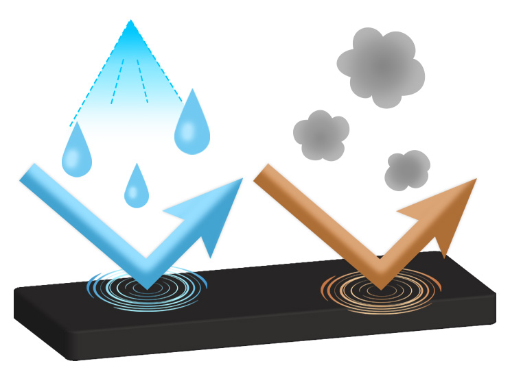
| Ingress | IP55 |
| Operating environment temperature | -40℃ to +80℃ |
| Manufacturer | AM Telecom Co., Ltd. |
Supports multiple GNSS
With technology that uses multiple GNSS satellite positioning systems at the same time, such as the Japanese quasi-zenith satellite Michibiki (QZSS) and Russia's GLONASS, it is possible to acquire position information with higher accuracy than conventional models.
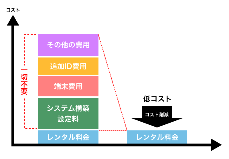
Cost reductions for using the service
Since there is no need to bear any other operational costs such as system development / installation fees, device costs, and additional ID costs, it is extremely easy and inexpensive to introduce the service.
Easy to use anytime, anywhere
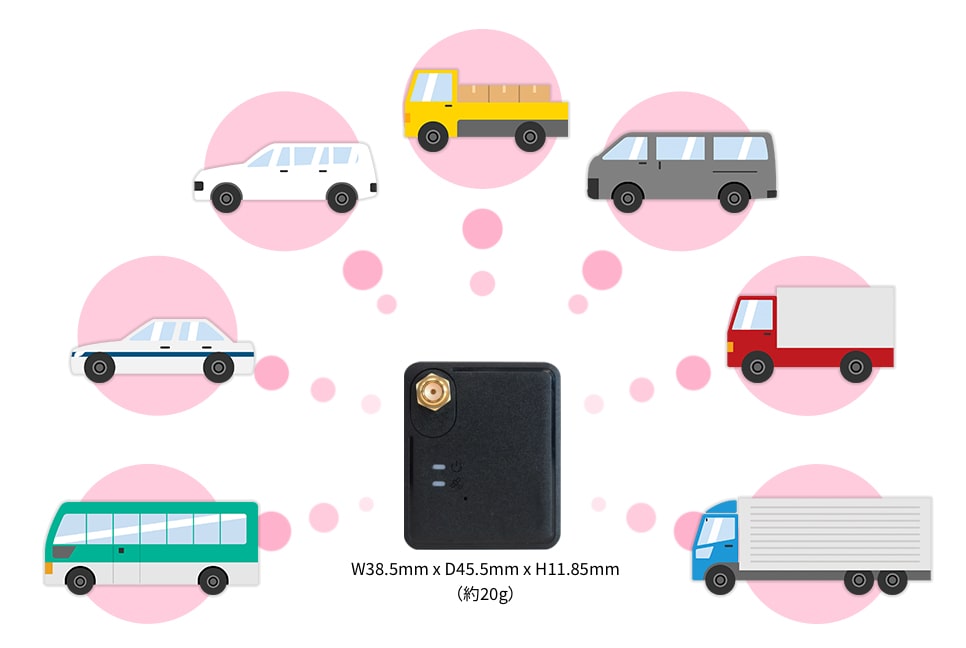
docomap GPS is a small and lightweight GPS terminal that is easy to install and carry. You can easily use the service anytime, anywhere. In addition, it can be used for all forms of businesses that involve vehicles, and not just for the logistics industry.


docomap JAPAN ・ Customer Support
03-6809-2105
Business hours 9:00 ~ 18:00 (Except weekends and holidays)